Day 13
09/01/2022|
The waist belt of my backpack needs continual adjustment as I shed layers of complacency and stagnation (which were apparently plaquing up around my waistline). I had not even been aware of that buildup or of how much it was weighing me down.
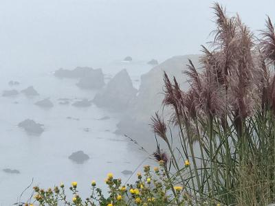
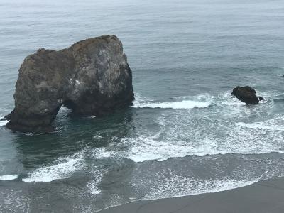
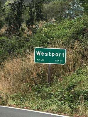
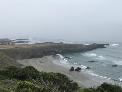
Today started a couple of miles south of Westport on a stretch of California coast that few notice as they fly by. The town of Westport is quaint, simple, beautiful. One little tsunami and it would all be gone. There is a general store and the owner offered water, interest in my mission, a ride to Laytonville (he was going anyway) and advice on crossing over Branscomb Road when I turned down the latter.
There are no public facilities in Branscomb”, he said, “no water—no town, really. Just a bunch of houses. And you’ve got a 2,000 foot elevation gain for the first 8 miles.”
“What about wild water?” I asked.
He looked skeptical. “I wouldn’t drink it—there’s creeks, and the headwaters of the Eel River.”
Hunh. I had thought to plant water every 5 miles on this stretch, as I did along the route to Fort Bragg, but couldn’t justify all that driving, simply to set myself up to walk. I had decided to let go, and engage in a Trust practice. Time to start trusting.
I had also been advised previously that Branscomb Road was long, windy, and dangerous for pedestrians.
Two miles past Westport I turned on Branscomb, and found it utterly delightful. Far less traffic than Hwy 1—a car or 2 every half hour. And despite what it seems like from inside a vehicle, I felt safer on this route than any stretch to date. I am paying attention on the road. I hear the cars long before they see me and I always have a place to get out of the way.
To receive moisture as it was offered, I ate large amounts of blackberries, rationalizing that it was okay to pick them along such a minimally traveled road…and one, perfect blueberry.
At about mile 6, I started seeing abundant graffiti all over the road—love, hate, declarations and self-identification.
Then, I came upon a young-person party of three, complete with boom box on top of their car. They had been following my progress since Westport, they said, and cheered as I crested the top. This overlook is known by the local youth as Lovers Lane (and graffiti depot). It was all downhill from there. Happy to have somehow shaved two miles off the uphill grade, I started down listening carefully for water. I wanted it as close to the source as possible for cleanliness.
Two miles down I started to hear water just as I was passing a logging operation. A little ways further I saw a good access point and shedding my pack, eagerly grabbed my canteen for a refill. What I found was a horrifying white effluent, apparently coming from the logging area. I don’t know what it was, but even if it wasn’t as toxic as it looked, I can’t imagine that the local aquatic creatures could see to navigate through it. No one would drink this who had a choice. Hard pass. Trust.
Mile after mile I checked in to find the creek slowly but consistently clearing. Long ago I was given the gypsy formula that water was drinkable after passing over seven stones. I think those were old-time gypsies who lived in a very different world.
Just before Branscomb my trust paid off. A side tributary bubbling fresh and clean out of the mountains. Climbing down the rocks with my canteen, I saw a fish swimming in the pool and a salamander lazing on a shaded rock. They each had only a single head. I was good for the night.

Click on the images to see larger versions